Skip to content
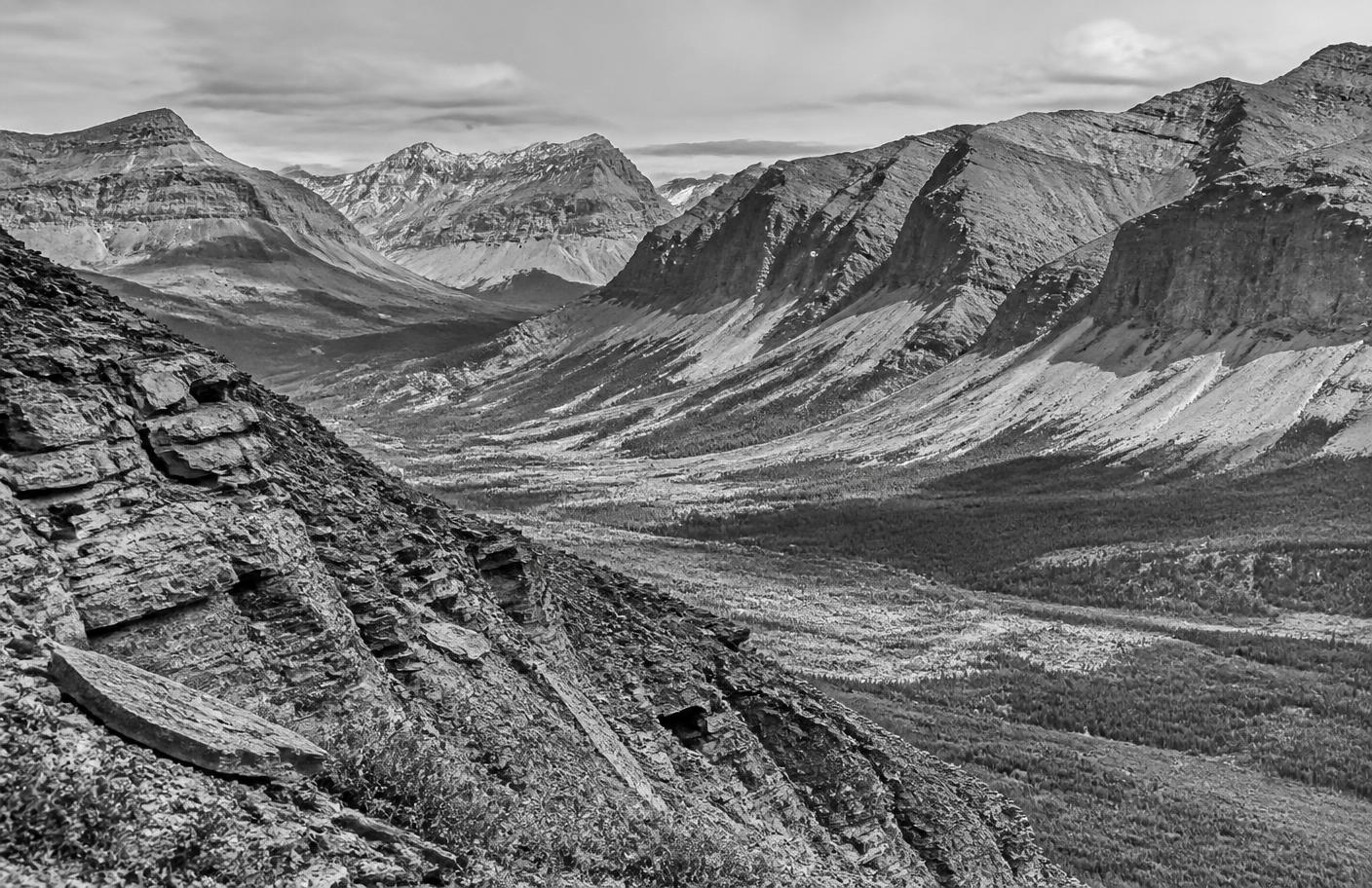
Grayscale mountain terrain of the Kechika Trough district in northeastern British Columbia

Regional exploration - Kechika Trough, northeastern British Columbia

Kechika Regional Project

Eleven zinc-lead-silver exploration property blocks across 682 km² of northeastern British Columbia, including two historically drilled prospects with high-grade results.

Overview

The blue-sky district play

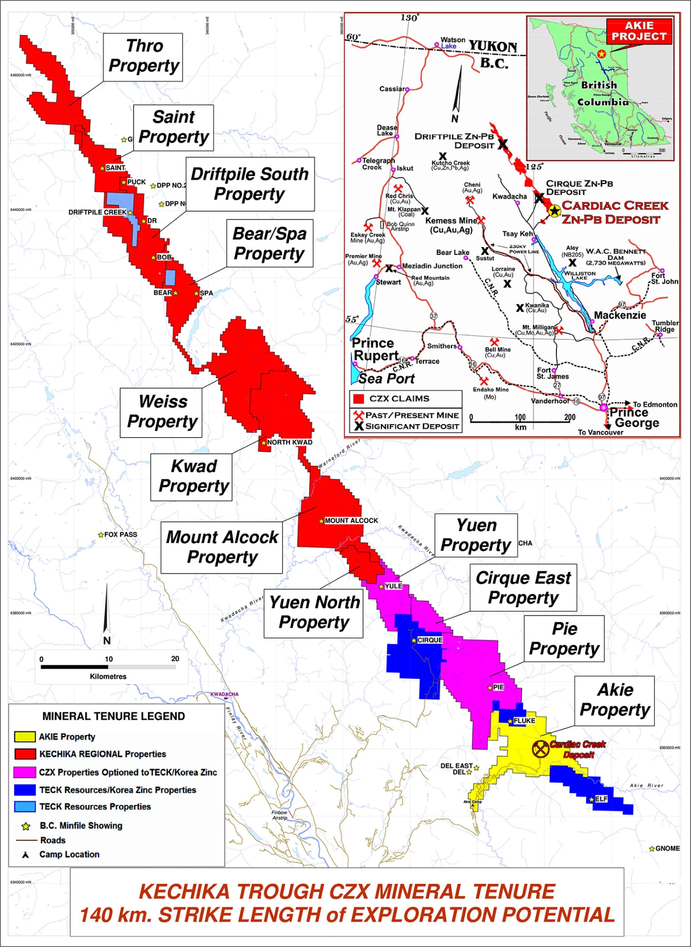
The Kechika Regional Project consists of 11 different property blocks comprised of 184 mineral claims covering an approximate area of 682 km². The project is located in northeastern British Columbia within the geological district known as the Kechika Trough. The property blocks, from south to north, include: Pie, Cirque East, Yuen, Yuen North, Mt. Alcock, Kwad, Weiss, Bear/Spa, Driftpile South, Saint, and Thro. The Company owns 100% of eight of the eleven property blocks and maintains a significant, 49%, interest in the Pie, Cirque East, and Yuen properties with partners Teck Resources Ltd. and Korea Zinc Co. Ltd.

11Property blocks
184Mineral claims
682 km²Total land package
Kechika Trough CZX mineral tenure map showing the eleven Kechika Regional property blocks and the Akie property along 140 km of strike length, with the regional infrastructure inset
Tenure Map of the Kechika Trough

Exploration of the various property blocks has been intermittent. The discovery of the Driftpile deposit in prompted a flurry of exploration activity within the project area with the majority of the work occurring in the late 1970’s and early 1980’s that was focused primarily on the northern properties as well as the Pie property in the south. Archer Cathro & Associated Ltd. managed the exploration efforts on behalf of the Gataga Joint Venture which consisted of Aquitane Co of Canada, Chevron Canada Ltd., Getty Mining Pacific Ltd., and Welcome North Mines Ltd. who along with Cyprus Anvil and other small operators conducted the bulk of the exploration in the district. This included extensive geological mapping and soil sampling as well as prospecting, rock sampling and localised ground geophysics. Work in the late 1980’s and early to Mid 1990’s was focused primarily on the southern properties such as Pie and Mt. Alcock by Triumph Resources Ltd. and Ecstall Mining Corp. Recent drilling in 2006 by Ecstall Mining was focused on the Pie property. The historical drilling on the Kechika Regional Project defined two major occurrences of Zn-Pb-Ag mineralisation on the Bear/Spa and Mt. Alcock properties.

Ken MacDonald P.Geo., is the designated Qualified Person as defined by the National Instrument 43-101 and is responsible for the technical information contained herein.

Geology & Mineralisation

Two prospects, one geological system

The Kechika Regional Project is situated within the fold and thrust belt of the Rocky Mountains. The project geology is characterised by a series of imbricated thrust panels comprised of Cambrian to middle Devonian aged rocks of the Kechika, Road River and Earn Groups. The Earn Group is comprised of the Warneford Formation: coarse clastic sediments, the Akie Formation: soft aluminous shales; and the highly prospective Gunsteel Formation which is characterised by bluish-grey weathered black siliceous shales.

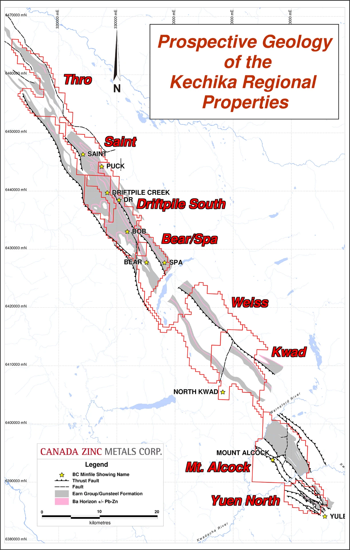
The project mineral claims cover the three known thrust panels of Earn Group stratigraphy within the Trough. The Eastern panel is present from the Akie property before pinching out along the eastern edges of the Pie property. The Central panel can be traced the entire length of the Kechika Regional Project from the Akie to the Thro properties covering a strike length of approximately 140 kilometres. The Western panel extends from the Akie to Mt. Alcock properties before pinching out on the Mt. Alcock property. The mineralisation present on the Bear/Spa property is hosted within the Central panel and the mineralisation present on the Mt. Alcock property is hosted within the Western panel.

Prospective geology of the Kechika Regional Properties map showing the Thro, Saint, Driftpile South, Bear/Spa, Weiss, Kwad, Mt. Alcock, and Yuen North property blocks
Prospective geology of the Kechika Regional Properties - Canada Zinc Metals Corp.

Mt. Alcock Prospect

The Mt. Alcock Zn-Pb-Ag mineralisation is marked by a prominent white weathered kill zone at surface. Sampling by D.G. MacIntyre in 1979 indicated the presence of dark gray bedded barite containing diffuse bands of galena and sphalerite returning potentially economic grades of Pb, Zn, and Ag.

Sample #Pb (%)Zn (%)Ag (ppm)Ba (%)
AL-113.00.112450.5
AL-210.81.411749.3
AL-38.42.411550.3
AL-410.04.812050.8
AL-56.81.071551.8

Mt. Alcock grab sample results (MacIntyre 1979)*

Historical drilling by Triumph Resources indicates that the mineralisation strikes southeast and dips shallowly to the southwest by an unknown extent.
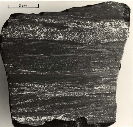
Mt. Alcock bedded barite with sphalerite and galena bands, sample AL-3
Mt. Alcock bedded barite w/ sphalerite and galena bands. Sample AL-3 (MacIntyre 1979)*

Untested upside - limited drilling, insufficiently tested
Bear/Spa Prospect

The mineralisation present on the Bear/Spa property is marked by a small gossan. Subsequent drilling programs by Archer Cathro in 1980 and 1981 identified the presence of at least two southeast striking steeply dipping mineralised horizons. The upper horizon consists of fine grained bedded barite with interstitial sphalerite and galena while the lower horizons is comprised of a non-baritic massively bedded pyrite.

Untested upside - limited drilling, insufficiently tested
(*) MacIntyre, D.G., 1979. Report on the Geology of the Southwest Corner of Kwadacha Wilderness Park and the Mt. Alcock Ba-Pb-Zn-Ag Showing, British Columbia Geological Survey, 12p.

Drilling & Results

Historical results, modern tools

Historical drilling has been completed on three properties within the Kechika Regional Project: the Mt. Alcock, Bear/Spa and Driftpile South properties. The drilling on the Mt. Alcock and Bear/Spa properties intersected potentially economic Pb-Zn-Ag mineralisation.

Mt. Alcock Advanced Prospect

  • Presence of potentially economic Pb-Zn-Ag mineralisation
  • Limited drilling - insufficiently tested
  • 9.30% Zn+Pb, 1.20 oz/t Ag over 8.8 metres intersected in drill hole AK 89-3, including 14.20% Zn+Pb, 1.60 oz/t Ag over 3.6 metres (*).
  • 6.90% Zn+Pb, 0.79 oz/t Ag over 10.5 metres intersected in drill hole AK 89-9 (*).
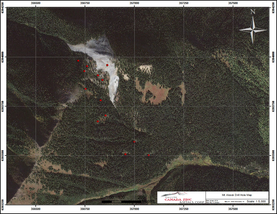
Drill hole location map on the Mt. Alcock property

In 1989 Triumph Resources Ltd. drilled the Mt. Alcock Ba-Pb-Zn-Ag showing with 9 holes totalling 1,111.60 metres with a focus on the prominent white weathered barite kill zone that is present on surface. The first drilling program intersected a significant body of bedded barite with seams of sphalerite and galena. The drilling returned some significant results indicating the potential of economic grades of Pb, Zn, and Ag.

Drill Hole #Core Length (m)Zn+Pb (%)Ag (oz/t)
AK 89-210.51.100.58
AK 89-38.89.301.20
includes3.614.201.60
AK 89-67.34.720.79
AK 89-74.01.00.07
AK 89-910.56.800.70

Table of significant results from 1989 drilling program (Murrell and Roberts 1990)*

The 1989 drilling program was followed up by additional drilling in 1990 conducted by Teck Corp. A total of 1,152.50 metres in 8 drill holes was completed. The 1990 program was focused primarily on the drilling of ground based Induced Polarization (IP) geophysical targets along the southeast strike extents of the showing. Other exploration work on the property by Triumph Resources and Teck Corp. has included extensive soil sampling, grab sampling, geological mapping, and ground based geophysical surveys.

The Company feels that the Mt. Alcock advanced prospect represents an exciting opportunity to make a significant and new discovery within the Kechika Trough.

(*) Murrell M. and Roberts W., 1990. 1989 Exploration Program on the Mt. Alcock Property in the Kwadacha Recreational Area, Northern British Columbia, Ministry of Energy and Mines, Assessment Report 19829, 111p.

Bear/Spa Advanced Prospect

  • Presence of potentially economic Pb-Zn-Ag mineralisation
  • Significant Pb, Zn, and Ag grades encountered
  • Limited drilling - insufficiently tested
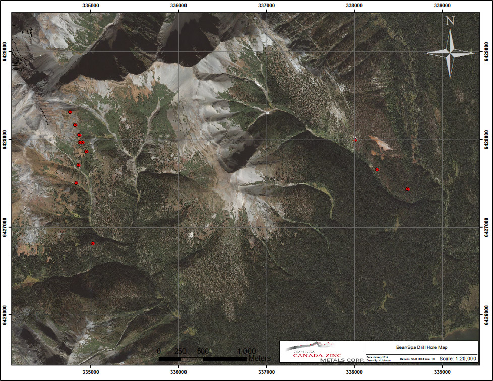
Drill hole location map on the Bear/Spa property

There have been two main periods of drilling on the Bear/Spa property, the early 1980s by Archer Cathro and in 1994 by Teck Corp. A very limited amount of drilling was completed in the 1970s on the eastern edges of the property that tested a very prominent and large iron seep known as the "Red/Spa Showing". The drilling by Archer Cathro in 1980 tested a distinct Pb soil anomaly. This resulted in the discovery of the Bear Pb-Zn-Ag mineralisation. A total of 822.6 metres of drilling were completed in 5 holes in 1980 and 2 more holes totalling 325.3 metres were completed in 1981. Teck Corp. tested the Bear prospect in 1994 and completed 8 drill holes. Only 2 of the 8 holes were made public so the bulk of the results from 1994 are unknown.

The drilling defined what appears to be two main horizons of mineralisation, an upper and lower separated by barren siliceous shale. Both horizons strike to the southeast and dip steeply to the south west. The upper horizon is comprised of finely crystalline, bedded barite with interstitial sphalerite and galena. The lower horizon is characterised by non-baritic massive bedded pyrite. The drilling also identified a mineralised zone hosted within cherty argillite much higher in the stratigraphy that contains discrete beds of sphalerite and galena. The main mineralised horizon is estimated to have a true thickness of up to 35 metres(*).

Drill Hole #Core Length (m)Zn+Pb (%)Ag (g/t)
80B-113.72.3234.3
80B-113.31.2722.5
80B-110.23.452.5
80B-29.13.7926.7
80B-215.63.9526.0
80B-211.51.6313.2
80B-312.92.9620.6
80B-312.32.530.5
80B-314.51.650.5
80B-417.11.9115.7
80B-412.21.627.9
80B-47.32.0712.7

Table of significant results from the 1980 Archer Cathro drilling of the Bear Prospect (Carne 1980)*

The early drilling by Archer Cathro demonstrate the presence of potentially economic Pb-Zn-Ag mineralisation. Samples taken showed the potential for high grade mineralisation with Pb grades up to 5.73%*, Zn grade up to 10.7%*. Silver values present within the mineralisation are significantly higher than what is encountered at the Cardiac Creek deposit with grades up to 52.5 g/t Ag*. The drilling tested the horizons over a strike length of approximately 800 metres and a very limited dip extent of approximately 100 metres. Historical recommendations stated that additional drilling was required to test the northwest extents of the mineralisation however no further work was pursued. Other exploration work on the property by Archer Cathro and Teck Corp. has included extensive soil sampling across the entire property, grab sampling, geological mapping, and ground based geophysical surveys.

The Company feels that the Bear advanced prospect represents an exciting opportunity to make a significant and new discovery within the Kechika Trough.

(*) R. C. Carne, 1980. Report on Diamond Drilling on the Bear and SI Claim Group, Ministry of Energy and Mines, Assessment Report 08626, 51p.

Exploration

Tremendous potential for new discoveries

Little to no modern exploration activities have taken place on the Kechika Regional Project over the past 30 years. The majority of exploration took place in the late 1970s to early 1980s. To advance the Kechika Regional Project the Company has initiated several efforts to enhance the prospectivity of the project and increase the chances for successful discovery.

Digital Exploration Database

The Company initiated a massive digital compilation effort bringing together a vast amount of public information into a single cohesive database involving data sets at a provincial level down to property scale. Everything from geological mapping, geochemistry (soils, silts, rocks, water, etc), airborne or ground-based geophysics, satellite imagery, air photos, reports, and other datasets have been incorporated into the database in order to be effectively utilized by modern 3D or GIS software packages.

A cohesive digital exploration database in excess of 155 GB in size has been compiled to facilitate further discovery.

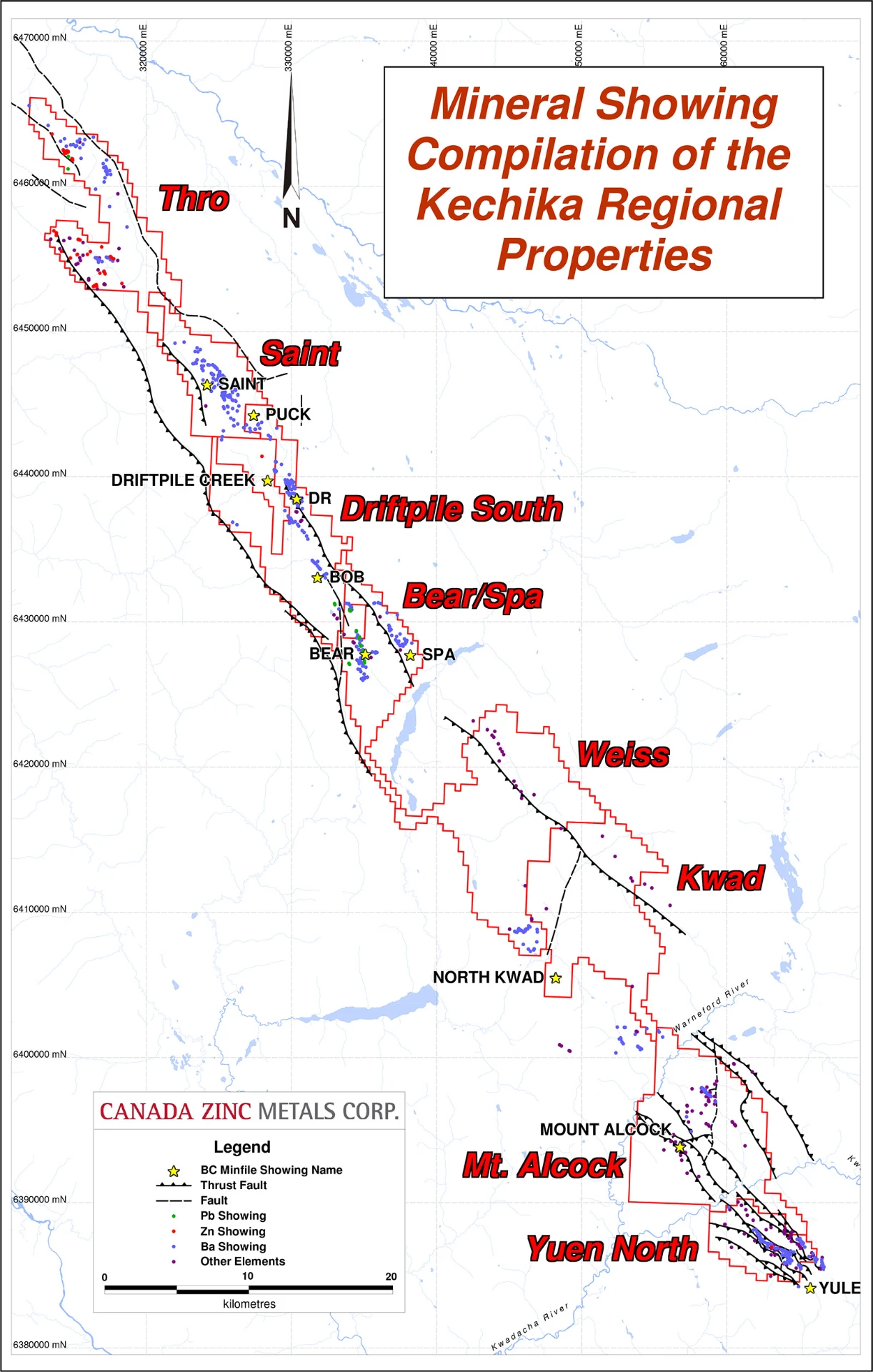
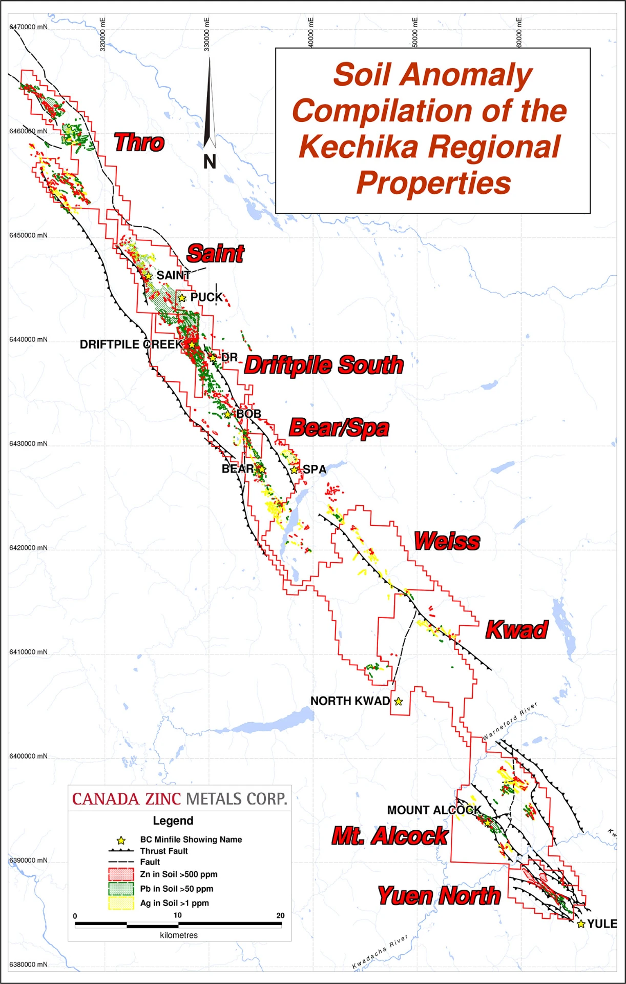
Some examples of the database that demonstrate its tremendous potential as a tool include:

Mineral showing compilation of the Kechika Regional Properties
Kechika Regional mineral showings compilation
Soil anomaly compilation of the Kechika Regional Properties
Kechika Regional soil anomaly compilation

Airborne Geophysics - VTEM

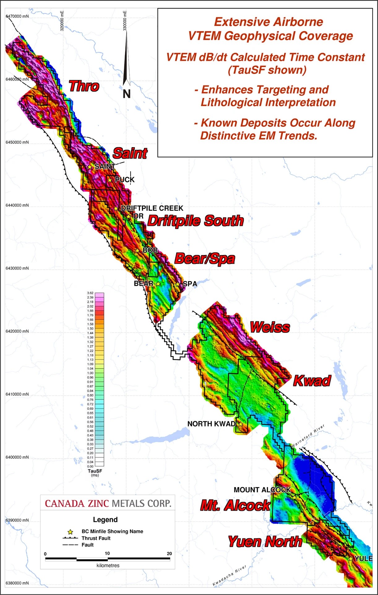
In 2012 the Company conducted a large scale airborne Vertical Time Domain Electro-Magnetic (VTEM) survey across its southern properties. In 2013 the survey was expanded to include all of the Kechika Regional Project properties with coverage extending the length of the Company's properties, some 140 kilometres of prospective ground. This dataset provided an immense amount of structural data as well as defined a distinct geophysical signature for the highly prospective Gunsteel Formation black siliceous shales leading to a reassessment of several properties within the project area, notably the Weiss and Kwad properties.

TauSF response across the Kechika Regional Project from the airborne VTEM survey
TauSF response across the Kechika Regional Project

Gravity Gradiometry

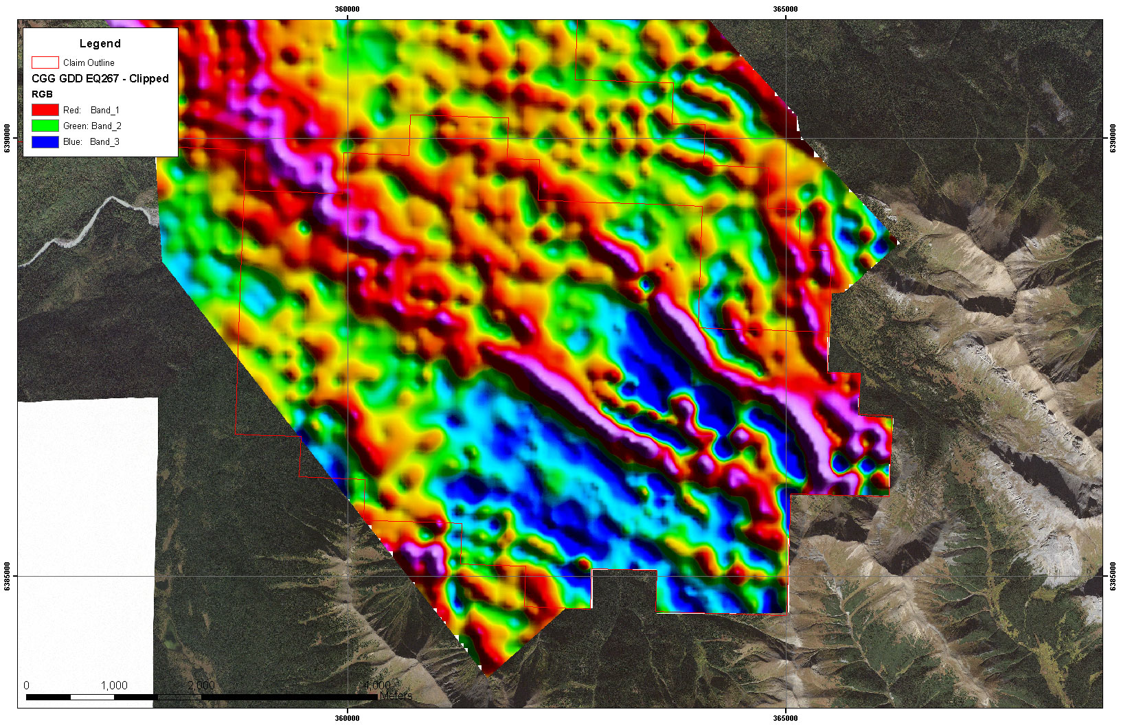
In 2015 the Company also conducted an airborne gravity gradiometry survey across its southern properties including Mt. Alcock and Yuen North in order to take advantage of the density contrasts that exist between known mineralisation (eg Cardiac Creek deposit) and the host black shales. Anomalies corresponding with known VTEM response and mapped Gunsteel Formation shales were generated.

GDD response over the Yuen North property

Satellite Structural Interpretation

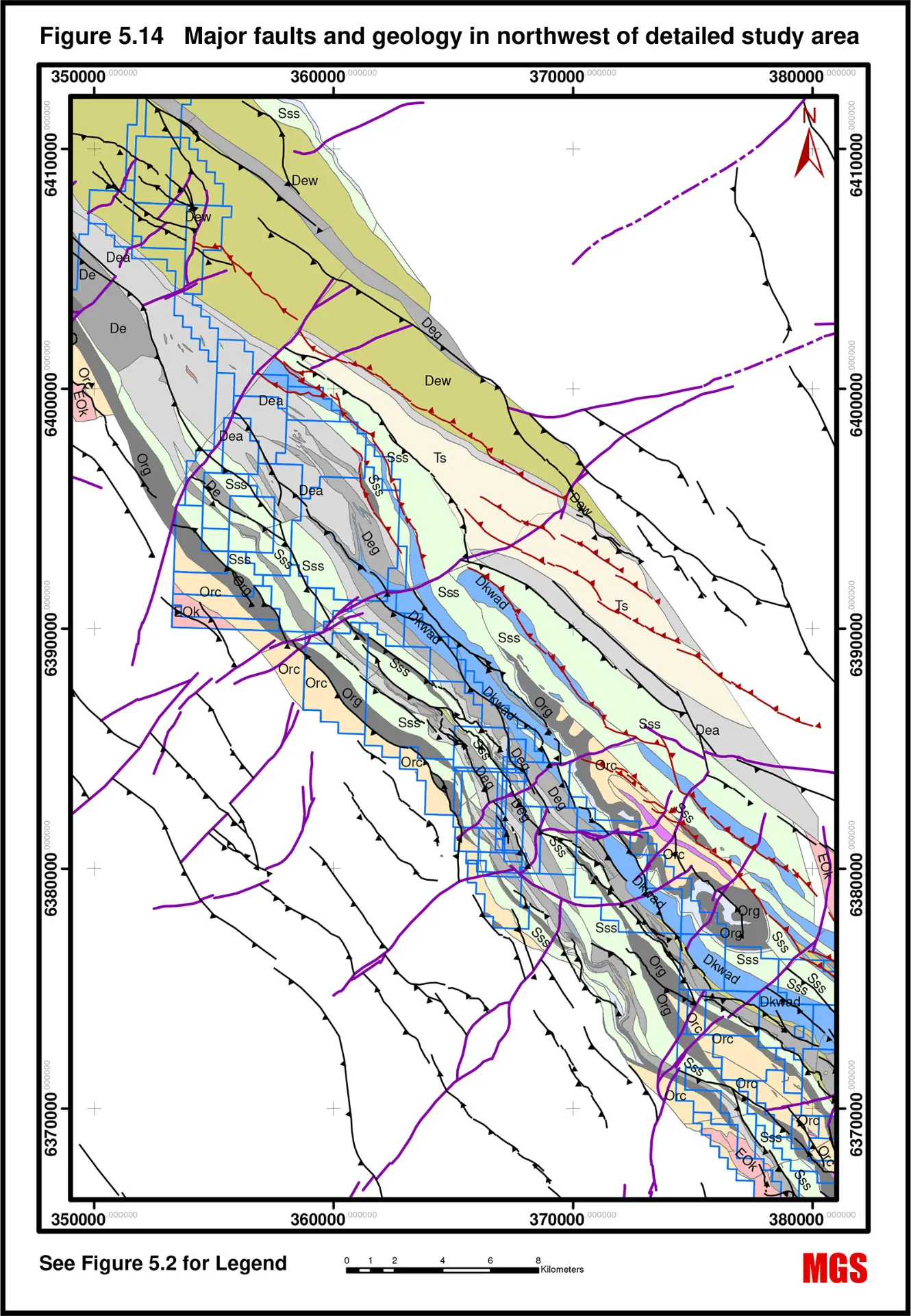
In 2017 the Company engaged Murphy Geological Services to conduct a structural interpretation across the southern properties of the Kechika Regional project based on high resolution satellite imagery in order to define the structural framework of the basin and to identify possible key structures that may have been conduits for hydrothermal fluids that formed Pb-Zn-Ag mineralisation.

Major faults and geology across the Kechika Regional southern properties

The Company continues to integrate and assess the geological data obtained from these surveys as well as the data contained within the digital database in order to generate and refine potential drilling targets as well as direct future exploration programs across the Kechika Regional Project in a cost effective manner.

Technical Reports

Project documents

A NI 43-101 compliant technical report was published in 2012 on the Mt. Alcock property. It can be found below as well https://www.sedar.com.