Skip to content
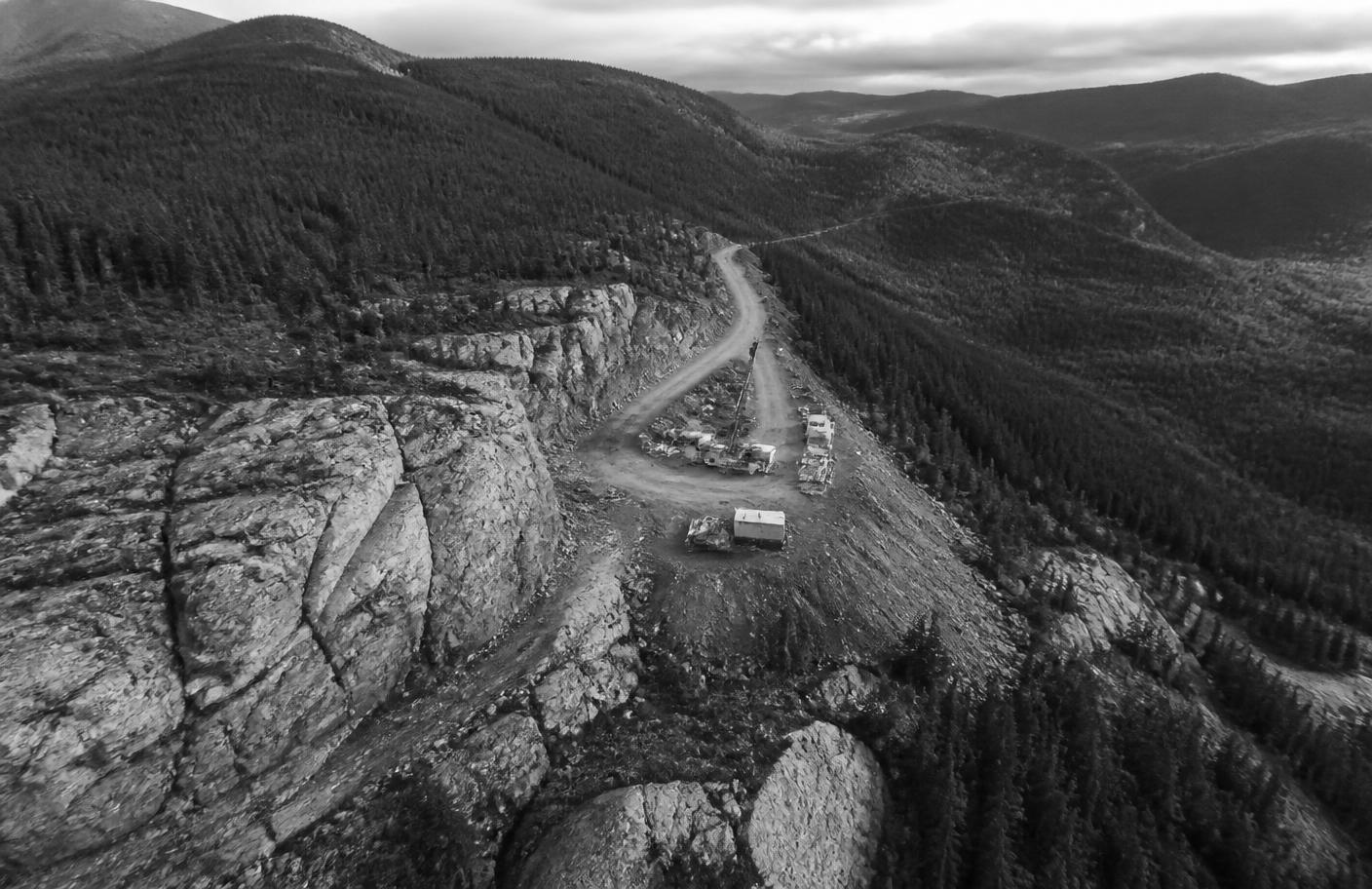
Remote exploration landscape and access road at the Akie Project

Flagship asset · Northeastern British Columbia

Advanced Exploration

Akie Project: Cardiac Creek Deposit

A 100%-owned, advanced exploration project in British Columbia, Canada, with a defined zinc-lead-silver mineral resource and existing road access, camp, and regional infrastructure.

Project overview

One Deposit. A District-Scale Position.

The Akie property consists of 46 mineral claims covering an area of approximately 116 km² and is located in northeastern British Columbia within the geological district known as the Kechika Trough. The property is named after the Akie River which runs along the southeastern boundary. The property is underlain by the prospective black siliceous shales of the Gunsteel Formation and is host to the Cardiac Creek deposit, a large sediment hosted stratabound SEDEX type Zn-Pb-Ag deposit. In late 2005, the Company entered into an option agreement with Ecstall Mining to acquire a 65% interest in the Akie property. Subsequently the Company acquired 100% of Ecstall Mining via takeover in 2007. The Company maintains a 100% ownership of the Akie Project. Since late 2005 to present day the Company has conducted numerous exploration programs completing a substantial amount of drilling that has been focused on defining its primary asset, the Cardiac Creek deposit.

These drill campaigns have defined a significant body of mineralisation. The current resource is summarized below in the Reserves & Resources section.

46mineral claims
116 km²property area
100%owned by ZincX
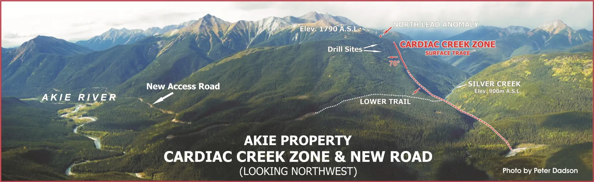
Aerial view of the Akie property showing the Cardiac Creek Zone surface trace, drill sites, new access road, and Akie River, looking northwest
Akie Property - Cardiac Creek Zone & new road, looking northwest. Photo by Peter Dadson.
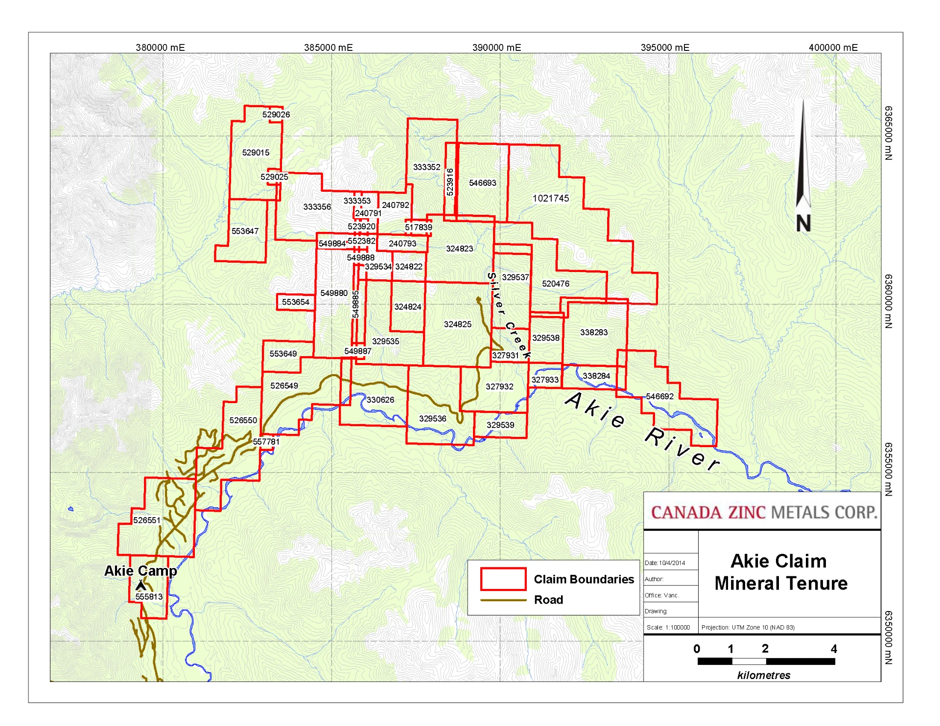
Akie claim mineral tenure map showing claim boundaries, roads, the Akie River, and Akie Camp
Akie claim mineral tenure. Source: Canada Zinc Metals Corp.

Geology & mineralisation

Reading the Rock

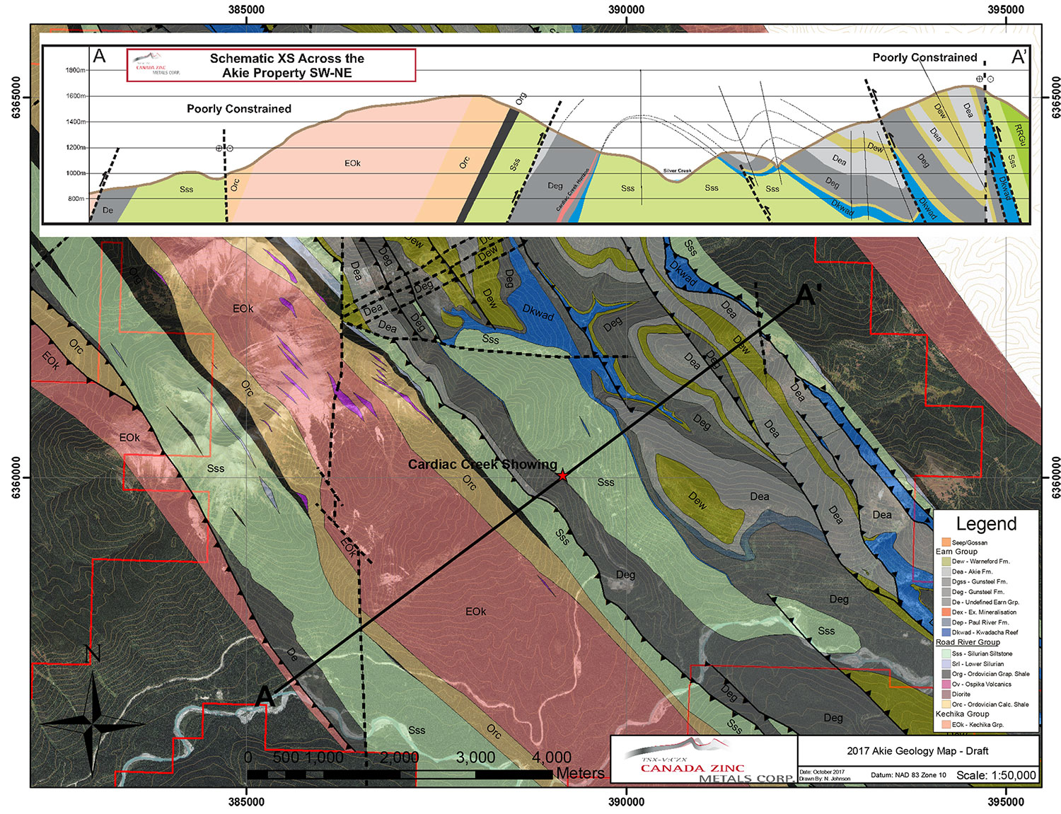
The Akie property is situated within the fold and thrust belt of the Rocky Mountains. The property geology is characterised by a series of imbricated thrust panels comprised of Cambrian to late Devonian aged rocks of the Kechika, Road River and Earn Groups.

The Earn Group is comprised of the Warneford Formation: coarse clastic sediments, the Akie Formation: soft aluminous shales; and the highly prospective Gunsteel Formation which is characterised by bluish-grey weathered black siliceous shales. There are three known thrust panels of Earn Group stratigraphy on the property, a western, central and eastern panel. The Cardiac Creek deposit is hosted by the Gunsteel Formation shales and located within the central thrust panel underlying the Cardiac and Avalanche Creeks just west of Silver creek.

The deposit is situated towards the base of the Gunsteel Formation located near the contact with the Road River Group. The mineralised horizon associated with the deposit can be traced over 7 kilometres from the Bear Valley Creek down to the Akie River. The deposit, representing the potentially economic portion of this horizon is a large tabular sediment-hosted stratabound SEDEX-type sulphide body that strikes northwest and dips steeply at 70° to the southwest and ranges in thickness from 5 to 50 metres. The mineralogy of the deposit is relatively simple, dominated by pyrite, barite, sphalerite and galena.

The deposit consists of two distinct mineral facies: The proximal facies, characterised by 20 to 60 centimetre thick, internally laminated, very fine-grained, dull brown pyrite beds with increasing amounts of with steel grey sphalerite bands towards the contact with the Cardiac Creek Zone; and the Cardiac Creek Zone characterised by 30 to 200 centimetre thick internally laminated sulphide beds very fine-grained, dull-brown pyrite, very fine-grained steel grey sphalerite bands with minor galena, and barite interbedded with generally featureless pyritic black siliceous shale beds. Higher grade Zn and Pb mineralisation is associated with a "mottled" texture within the sphalerite bands.

2017 Akie property geology map with schematic cross-section showing thrust panels, the Gunsteel Formation, and the Cardiac Creek showing
2017 Akie geology map with schematic cross-section across the property, SW-NE. Source: Canada Zinc Metals Corp.
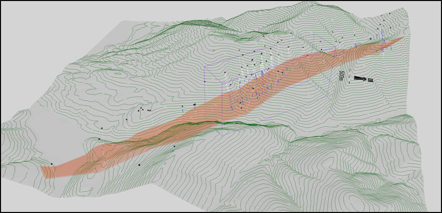
3D isometric view of the Cardiac Creek mineralised horizon with drill traces and the area of economic interest outlined
3D isometric view of the Cardiac Creek horizon. Area of economic interest outlined by rectangular box.

Drilling & results

A Systematically Tested Deposit

150+ holes

64,000m drilled

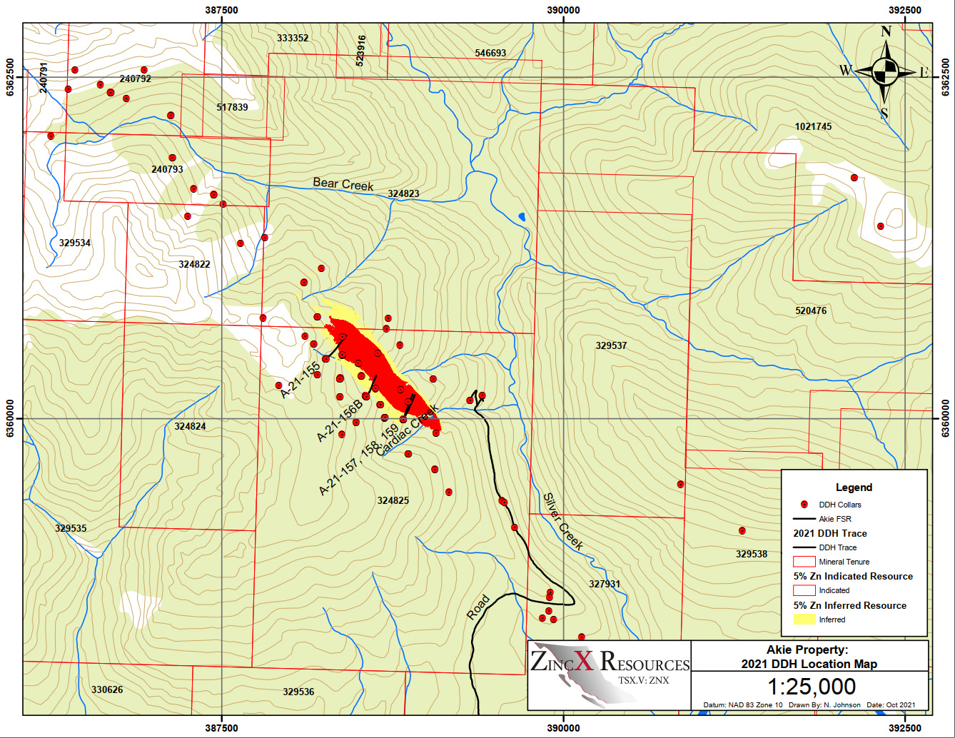
Since 2005, the Company has conducted several drilling programs focused on the expansion and delineation of their primary asset, the Cardiac Creek deposit. To date, over 150 drill holes have been completed totalling more than 64,000 metres of drilling (either abandoned or completed). A map of the drilling and a table of all the pertinent drill results can be seen below.

2021 drill hole location map of the Akie property showing drill collars, traces, the Akie FSR road, mineral tenure, and the 5% zinc indicated and inferred resource footprints around Cardiac Creek.
Akie Property: 2021 DDH Location Map, 1:25,000. Datum NAD 83 Zone 10, drawn by N. Johnson, October 2021.
Akie Property drill hole assay compilation, 2005 to 2021, listing hole, from, to, and zinc, lead, and silver intercepts by drill campaign.
Akie Property Drill Hole Assay Compilation 2005 to 2021. Scroll within the frame to review all campaigns.

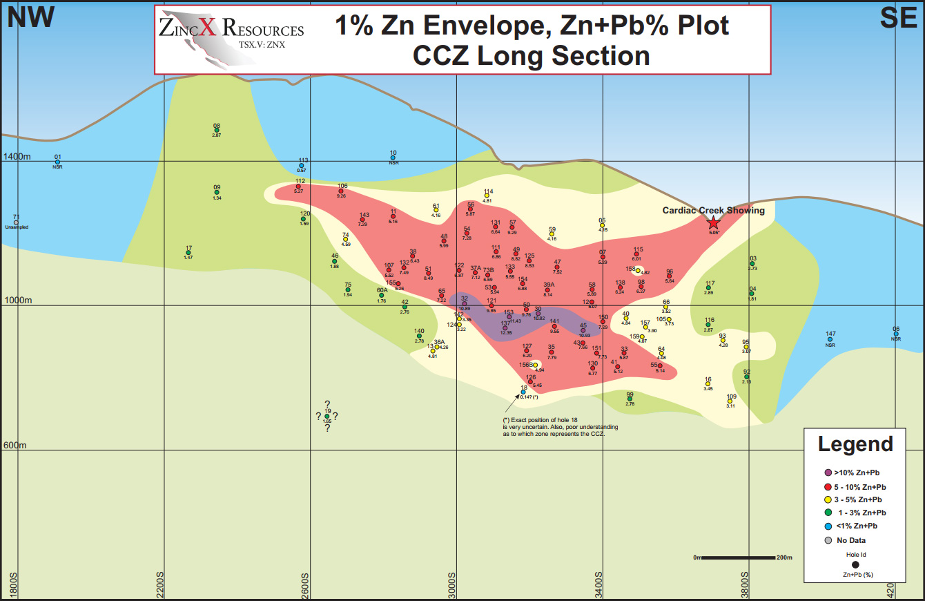
The drilling on the deposit has encountered what appears to be two different horizons of high-grade mineralisation, the Cardiac Creek Zone (CCZ) and the Footwall Zone (FW). Drill results indicate that there appears to be a high-grade corridor central to the deposit. The Zn+Pb% grades across both zones of mineralisation can be found in the following long section.

Cardiac Creek Zone long section, northwest to southeast, plotting drill holes within the 1% zinc envelope by combined zinc and lead grade, with a high-grade corridor centred on the deposit.
1% Zn Envelope, Zn+Pb% Plot - CCZ Long Section, looking southwest.

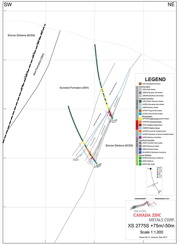
Select cross sections can be seen below depicting a schematic view of the Cardiac Creek deposit and results from recent drilling programs.

Schematic cross section XS 2775S at 1:1,000 scale across the Cardiac Creek deposit showing the Akie, Gunsteel, and Silurian formations with drill traces and mineralised facies.
Cross section XS 2775S +75m/-50m, scale 1:1,000. Canada Zinc Metals Corp., drawn by N. Johnson, December 2017.

The primary focus of the drilling has been the Cardiac Creek deposit however there are additional property scale targets have been drill tested at various times since 2005 or are being considered for future drilling. These include:

Reserves & resources

Indicated & Inferred Resources at Cardiac Creek

The drilling conducted by the Company on the Cardiac Creek deposit has defined both Indicated and Inferred Resources. The current resource was updated in late 2017 incorporating all the results from the 2017 drilling program. The updated resource can be seen in the table below.

Table 1: 2017 Sensitivity of Mineral Resources

Swipe horizontally to view all columns

2017 sensitivity of mineral resources for the Cardiac Creek deposit by zinc cut-off grade
Cut-Off Grade (Zn %)Tonnes (million)Zn (%)Pb (%)Ag (g/t)Contained metal
Zn (Mlbs)Pb (Mlbs)Ag (Moz)
Indicated Resources
241.56.081.1610.75,5631,06214.3
334.16.861.3211.95,16199413.0
428.17.581.4613.04,70090811.7
5 (base case)22.78.321.6114.14,16280410.3
617.99.081.7515.23,5846918.7
713.59.931.9116.42,9495677.1
Inferred Resources
230.04.110.697.52,7154557.3
318.55.150.899.12,0983615.4
411.86.111.0710.51,5912784.0
5 (base case)7.57.041.2412.01,1692052.9
64.87.971.4013.68351472.1
72.88.991.5915.4561991.4

Note: Mineral resources are not mineral reserves because the economic viability has not been demonstrated.

Comparison to Previous Resource

The current mineral resource estimate (November 2017) is compared to the previous mineral resource estimate (effective date May 16, 2016, presented in a technical report dated June 28, 2016).

Table 2: Comparison of November 2017 and May 2016 Mineral Resources (5% Zn Cut-Off)

Swipe horizontally to view all columns

Comparison of November 2017 and May 2016 mineral resources at a 5 percent zinc cut-off
ClassNovember 2017May 2016
Tonnes (000)Zn (%)Pb (%)Ag (g/t)Tonnes (000)Zn (%)Pb (%)Ag (g/t)
Indicated22,7028.321.6114.119,6478.171.5813.6
Inferred7,5257.041.2412.08,0706.811.1611.2

The 2016 resource can be found in the Company's previously released revised NI 43-101 Technical Report on the Cardiac Creek deposit entitled "Mineral Resource Estimate for the Akie Zinc-Lead-Silver Project, British Columbia, Canada" which can be found at www.sedar.com.

Robert Sim, P.Geo., is an independent Qualified Person responsible for the information related to the estimate of Cardiac Creek mineral resources contained in this information. Mr. Sim also served as the Qualified Person responsible for the preparation of the 2016 NI 43-101 Technical Report on the Akie Project and is responsible for the maiden 2008 and updated 2012 mineral resource estimates for the Cardiac Creek deposit.

Ken MacDonald, P.Geo., is the designated Qualified Person as defined by National Instrument 43-101 and is responsible for the technical information contained herein.

Infrastructure

Connected by More Than Geology

Infrastructure in the region has improved substantially since the discovery of the Cardiac Creek deposit in 1994.

Roads

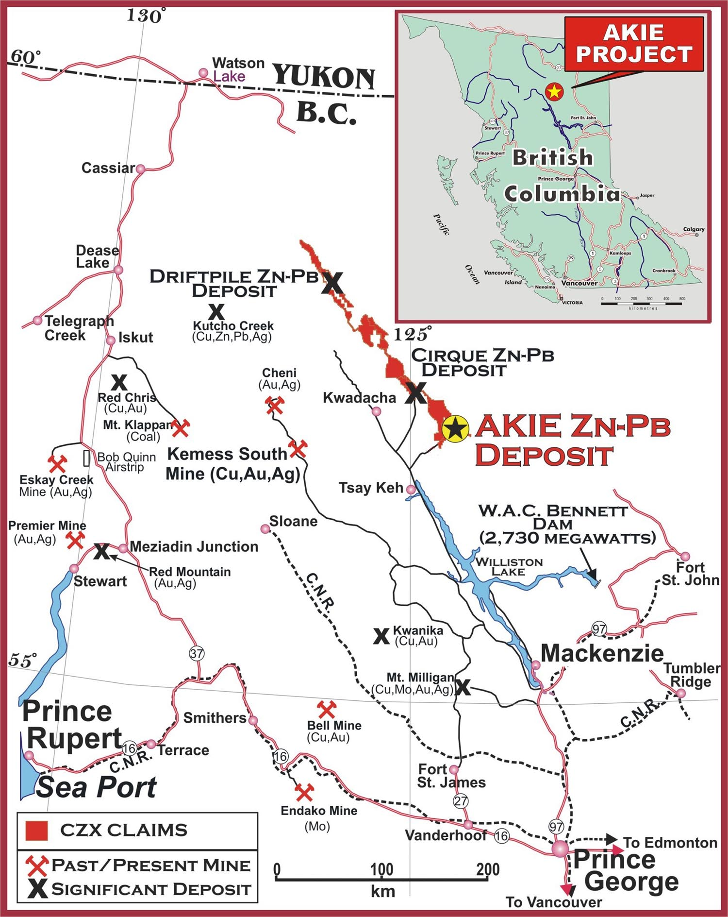
The Company extended the Akie FSR Mainline an additional 12 kilometres providing direct road access to the property in 2008. The Akie property is now road accessible by all-weather Forest Service Roads (FSR's). Located approximately 260km NNW of Mackenzie, BC and 450km NNW of Prince George, BC.

Regional map of northern British Columbia showing CZX claim blocks, significant zinc-lead-silver deposits, past and present mines, and the major road and rail routes connecting the Akie property to Mackenzie and Prince George.
Regional location map showing CZX claims, deposits, past and present mines.
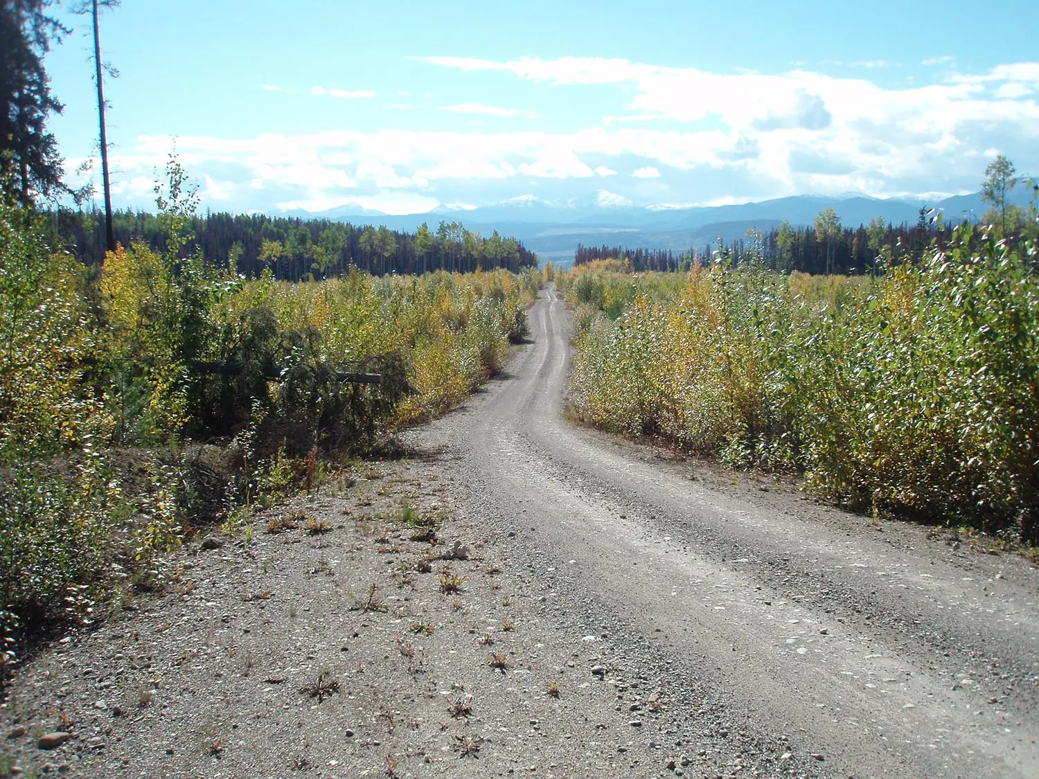
All-weather gravel Forest Service Road leading to the Akie camp and the Cardiac Creek deposit.
Akie Mainline to Akie Camp
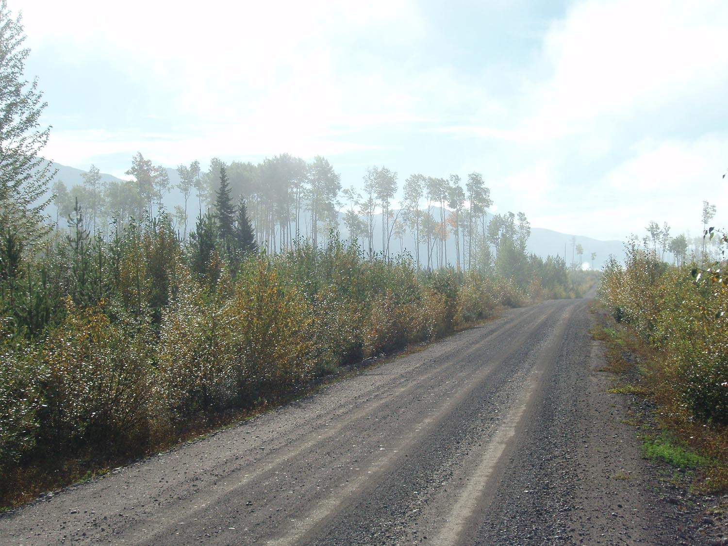
Finlay Mainline Forest Service Road winding through forested terrain toward the Akie property.
Finlay Mainline to Akie Camp

Rail and Highways

Access to paved highways and rail are located in Mackenzie, BC south of the project site. Major rail terminal is located in Prince George, BC.

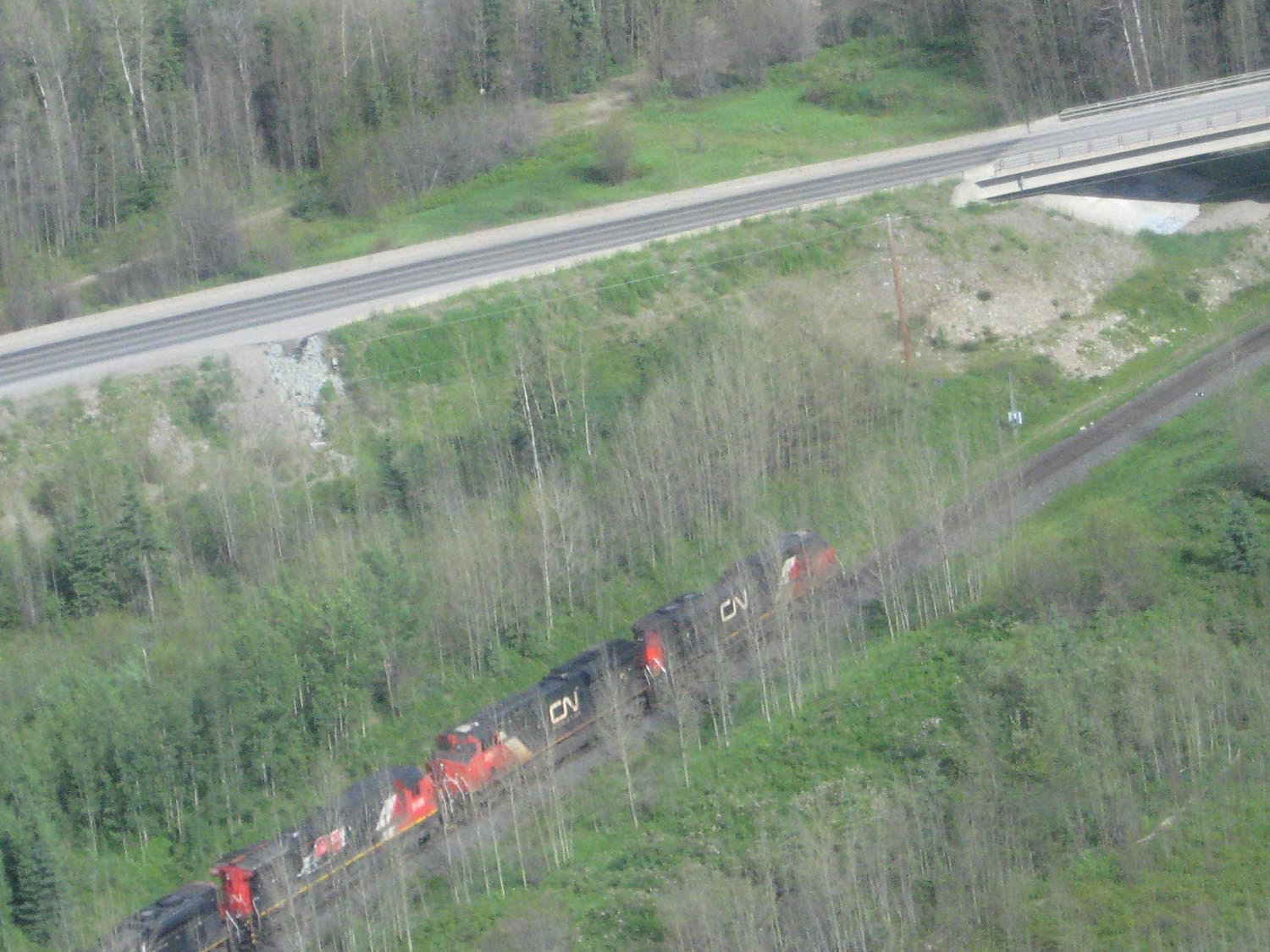
CN Rail freight train passing beside Highway 97 in northern British Columbia.
CN Rail and Highway 97 to Mackenzie, BC
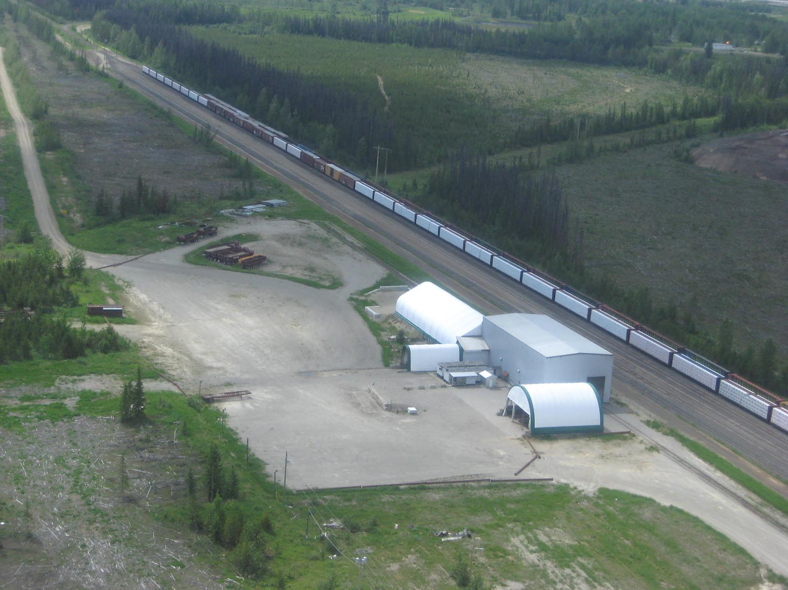
Aerial view of the concentrate loadout facility at Mackenzie, BC, used by the Mt. Milligan Cu-Au mine.
Concentrate loadout at Mackenzie BC, used by Mt. Milligan Cu-Au Mine
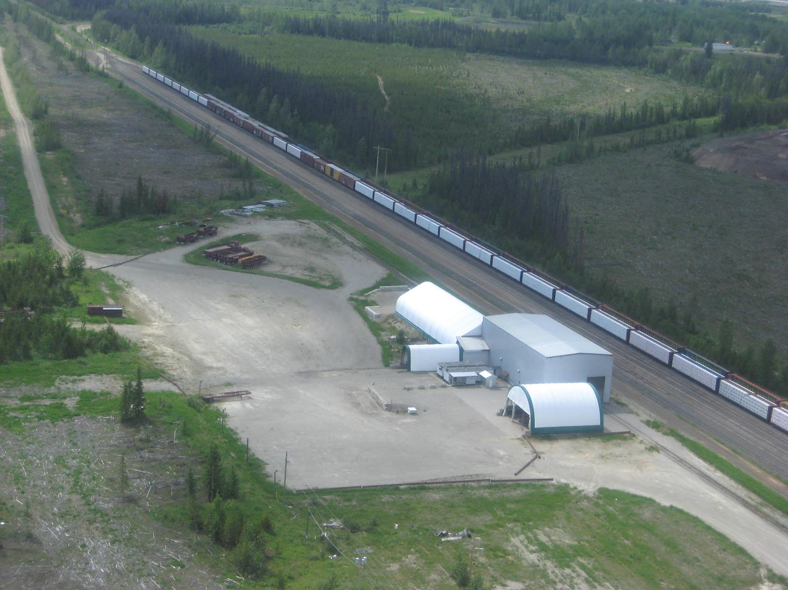
Aerial view of the concentrate loadout facility at Mackenzie, BC, with rail cars alongside the storage buildings.
Concentrate loadout at Mackenzie BC - aerial view

Power

The WAC Bennet Hydroelectric dam is located 160 kilometres southeast of the project. Power lines runs along the west side of the Williston Lake Reservoir supplying power to the Kemess Mine site via the Kennedy Substation located just south of Mackenzie BC.

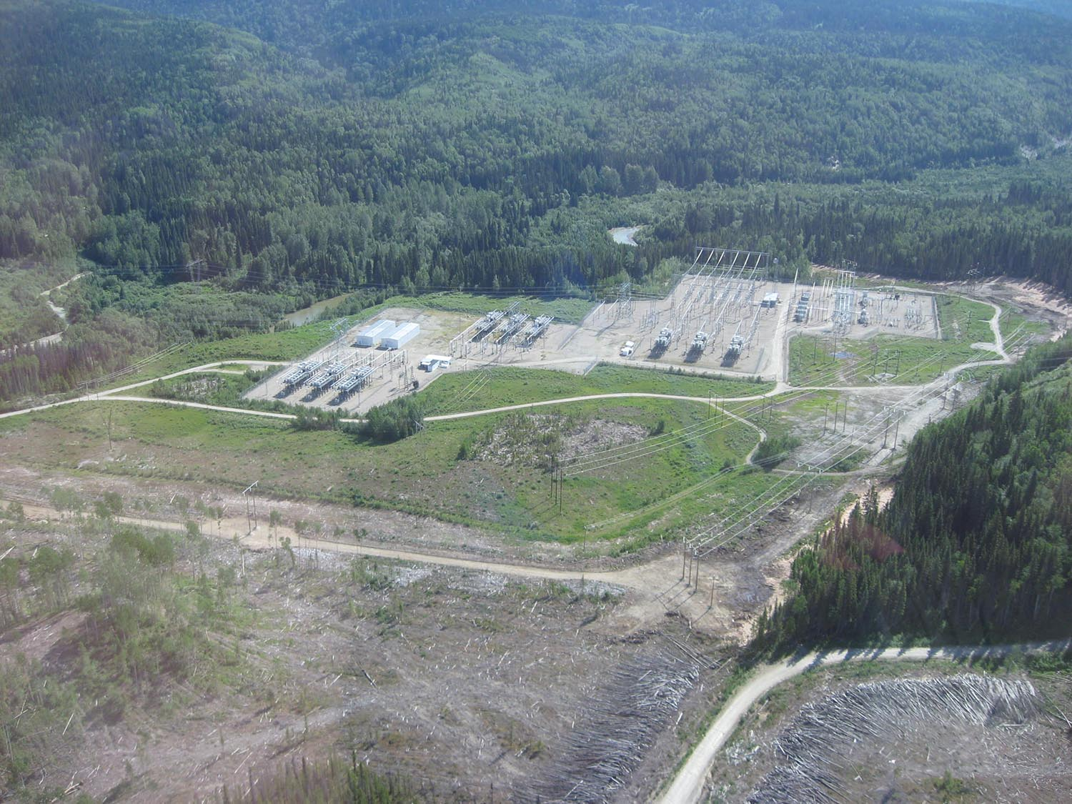
Aerial view of the Kennedy Substation south of Mackenzie, BC, surrounded by forest.
Kennedy Substation, south of Mackenzie BC
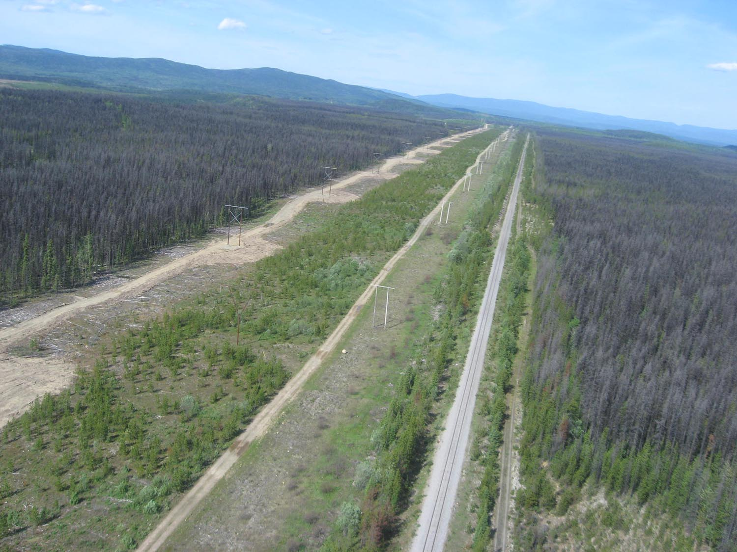
Aerial view of the powerline corridor running alongside the railway through northern British Columbia toward the Kemess mine site.
Powerline to Kemess & Railway

Camp

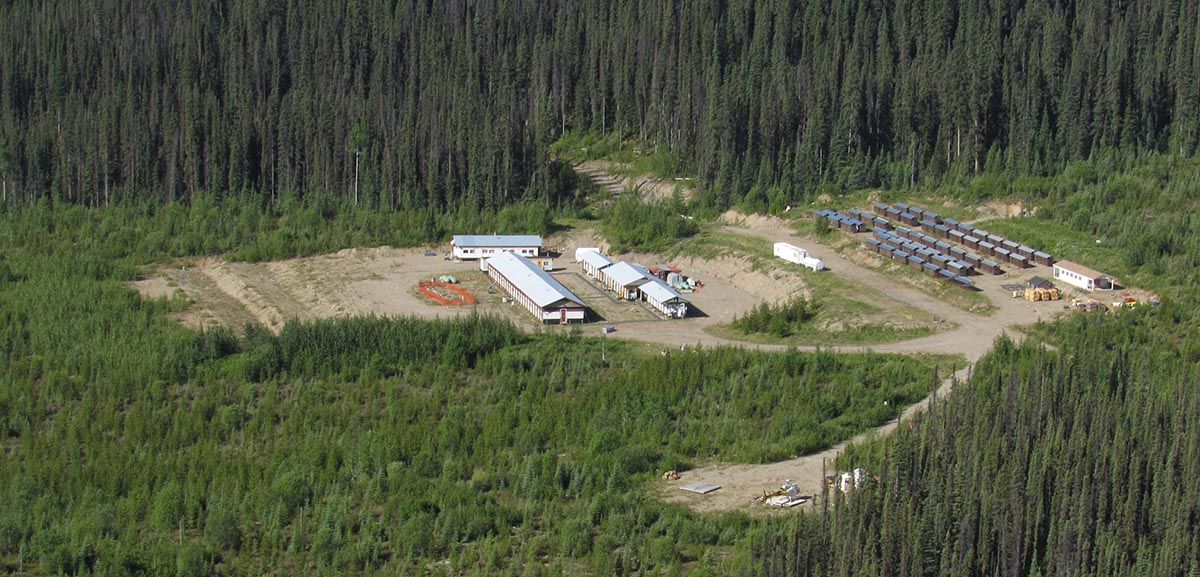
The Company constructed a 45-man ATCO trailer style camp in 2007 along the Akie Mainline FSR in an existing forestry cut-block. There is ample space to expand, if required, to meet any demands for future development.

Aerial view of the Akie exploration camp, a 45-man ATCO trailer style camp built in a forestry cut-block along the Akie Mainline FSR.
Akie Exploration Camp

Other

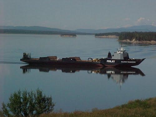
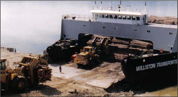
Canfor Corp. owns and operates the MV Williston Transporter, a large 360 foot long, 110 foot wide, 5000 tonne capacity, icebreaking barge which is based in Mackenzie, BC. The barge is primarily used to transport logs for the forestry industry however it was also intended to transport ore from the proposed Cirque Mine.

The MV Williston Transporter icebreaking barge crossing Williston Lake.
MV Williston Transporter Barge
The MV Williston Transporter barge being loaded with logs at the shoreline.
MV Williston Transporter Barge loading

Underground

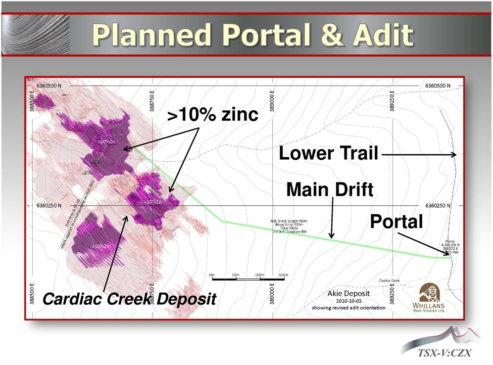
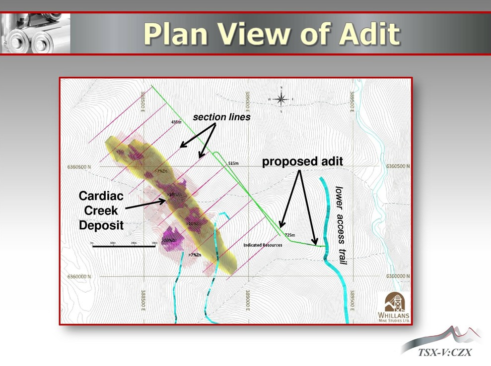
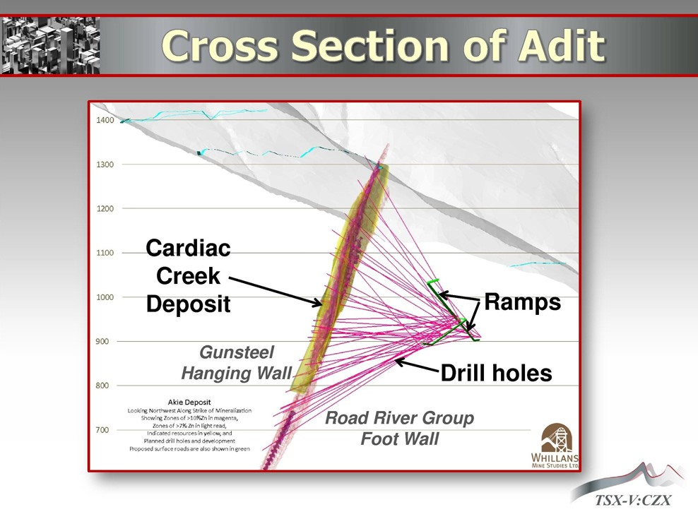
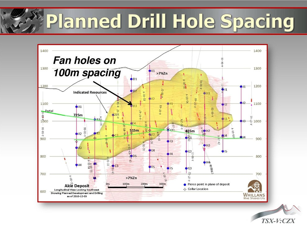
Further delineation and exploration drilling at the Cardiac Creek deposit is being considered using underground drilling stations located in the footwall of the deposit on the 950m elevation. The proposed underground program is currently permitted, and all engineering designs and plans are complete in order to commence the underground drill program. Surface work associated with the proposed underground program has already been developed and includes: portal access road, clearing of the proposed portal site, and construction of a temporary waste rock dump with settling ponds.

The images below are representative of the proposed underground program.

Planned portal and adit plan showing the Cardiac Creek deposit, main drift, lower trail and portal location.
Planned Portal & Adit
Plan view of the proposed adit with section lines and the lower access trail relative to the Cardiac Creek deposit.
Plan View of Adit
Cross section of the proposed adit showing ramps and planned drill holes beneath the Cardiac Creek deposit.
Cross Section of Adit
Planned underground drill hole spacing showing fan holes on 100 metre spacing across the deposit.
Planned Drill Hole Spacing

Technical reports

Project Documents

A total of four NI 43-101 technical reports have been published on the Akie Project. The first technical NI 43-101 report on the Akie Project was published in late 2005 just prior to the discovery of the high-grade core of the Cardiac Creek deposit. The maiden resource estimate was published in 2008 and subsequently updated in 2012 and 2016. The 2018 PEA NI 43-101 technical summary report represents an update from the 2016 resource estimate and can be found below.

The previous NI 43-101 reports can be found at https://www.sedar.com.

Exploration presentation

2016 Cordilleran Round Up Presentation

Cardiac Creek Zinc-Lead-Silver Deposit: Update and Insights on a Growing Resource, Akie Property, British Columbia

Nicholas Johnson, Exploration Manager, Canada Zinc Metals Corp.

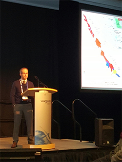
Nicholas Johnson delivering the Cardiac Creek technical talk at the 2016 Cordilleran Round Up in Vancouver
2016 Cordilleran Round Up, Vancouver

The Cardiac Creek deposit, Akie property, is located in the Akie River Valley of northeastern British Columbia, approximately 260 kilometres NNW from the town of Mackenzie. The property is situated within the Kechika Trough, the southeast extension of the prolific Selwyn Basin. The sequence of fine-grained clastics from the late Devonian Earn Group are considered the prospective rocks in the Kechika Trough. Specifically, all of the deposits (Cardiac Creek, Cirque) and occurrences (Mt. Alcock, Elf) are hosted by the carbonaceous, siliceous shales of the Gunsteel formation, the basal unit of the Earn Group.

The Cardiac Creek deposit has been the focus of Canada Zinc Metals exploration efforts since September 2005. The deposit is a NW-SE trending, SW dipping planar body of mineralisation with current approximate dimensions of 1300 metres in strike length and a dip extent of 800 metres. To date, the deposit has been tested by 79 drill holes totaling just over 42,600 metres, including 8 drill holes in 2015. Drilling from 2011 and earlier defined a NI 43-101 compliant indicated resource of 12.7Mt grading 8.4% Zn, 1.7% Pb and 13.7g/t Ag and an inferred resource of 16.3Mt grading 7.4% Zn, 1.3% Pb and 11.6g/t Ag (at a 5% Zn cut-off grade).

Stratigraphically, the mineralisation is positioned just above the base of the Gunsteel formation and is underlain by debris flows of the Paul River formation and siltstones of the Road River Group. The mineralisation is located at a transition point between the Kwadacha Reef to the east and deep-water clastics to the west. The deposit, marked along its upper contact by a distinctive quartz-carbonate vein zone, appears to be bifurcated into two distinct horizons, the Cardiac Creek Zone and the Footwall Zone. The mineralisation is characterised by two distinct facies: Proximal facies, defined by thickly bedded fine-grained dull brown pyrite with minor sphalerite banding, and the Cardiac Creek Zone, defined by thick bands of steel grey sphalerite and galena interbanded with pyrite, barite and shale. High-grade Zn and Pb is associated with a quartz-barite mottled texture within the sphalerite bands.

Since 2011, the company has focused on expanding the known limits of mineralisation as well as defining the high-grade core of the deposit which remains open primarily down-dip and along strike to the northwest. Aspects such as: element ratios, localized alteration, sulphide breccias, the presence of massive sulphide lenses and, surprisingly, concretions all correlate with the high-grade core. Recently, airborne geophysics (VTEM and Gravity) have been used to define lithological units, structure and provide a deposit signature to assist exploration on the property and regionally.

Drilling since 2010 has also intersected several thin intervals of mineralisation associated with Paul River formation rocks that are enriched in a suite of elements including Ni, Zn, Pb, Mo, U, V. This represents a new style of mineralisation in the Kechika Trough and is similar in character to the Nick deposit, Yukon.